ERAU’s team flags UAS risks; will White House DRONE DOMINANCE delay fixes???
Below is the Small Unmanned Aircraft System (sUAS) Traffic Analysis study, recently issued by ERAU, Kansas State, Wichita State and NAIR. The FAA and DOT commissioned this academic consortium to assess real-world drone activity across the National Airspace System (NAS) under the auspices of Alliance for System Safety of UAS through Research Excellence.
The experts recommend a number of risk reduction strategies- operational and research– in their 153 page document. Two hot spots were flagged in their assessment of UAS operations (specifics will be discussed in greater depth in following paragraphs).
CRITICS RECENTLY HAVE FOUND FAULT WITH THE FAA’S FAILURE TO RECTIFY, ON EXPEDITED BASIS, IDENTIFIED RISKS.
Could the following policy directive from 1600 Pennsylvania Avenue interfere with implementing preventative actions???
White House June 6,2025 (eVTOL (references deleted) :

“UNLEASHING AMERICAN DRONE DOMINANCE: Today, President Donald J. Trump signed an Executive Order to ensure continued American leadership in the development, commercialization, and export of unmanned aircraft systems (UAS)—otherwise known as drones.
- The Order directs the Administrator of the Federal Aviation Administration (FAA) to expand drone operations by enabling routine “Beyond Visual Line of Sight” drone operations for commercial and public safety missions, and to accelerate the development, testing, and scaling of American drone technologies, including advanced air mobility and autonomous operations.
…
- It directs the FAA Administrator to deploy artificial intelligence (AI) tools to streamline and expedite UAS waiver reviews.
- The Order directs the FAA Administrator to publish an updated roadmap for the integration of civil UAS into the National Airspace System.
- It strengthens the domestic drone industrial base by prioritizing U.S.-manufactured UAS, promoting their export and taking action to ensure our technology remains secure from undue foreign influence and exploitation.
- It enhances global competitiveness by streamlining regulations, expanding market access, and utilizing federal financing tools.
…
DRIVING INNOVATION AND ECONOMIC GROWTH: President Trump is harnessing the potential of drones to boost American productivity and global leadership.
- Drones enhance U.S. productivity, create high-skilled jobs, and are reshaping the future of aviation in areas such as logistics, infrastructure inspection, precision agriculture, emergency response, and public safety.
…
- .
- For too long, unfair foreign competition has posed a national security risk, disincentivizing our drone industrial base. This order is removing regulatory barriers and directing federal agencies to prioritize U.S.-manufactured drones, secure our supply chains, and promote American leadership in production, certification, and export.
ADVANCING DRONE TECHNOLOGIES: President Trump is advancing drone technologies for economic, security, and public safety benefits.
- In his first term, President Trump signed a Presidential Memorandum to speed up commercial drone integration, launching a UAS Integration Pilot Program to test innovative applications with State, local, and tribal partners.
- President Trump has deployed UAS to patrol the southern border, strengthening national security through advanced surveillance and monitoring capabilities.
- President Trump has advanced cutting-edge drone technologies through smart, targeted regulation, unlocking economic growth while strengthening safety, security, and innovation.
What are the serious concerns raised by ERAU et al? Here is a summary:
Of the 6,037 flights with altitude data, 573 operated between 400–500 feet, and 781 exceeded 500 feet—well above the FAA’s 400-foot ceiling for sUAS. These flights accounted for roughly 10% of total cumulative flight time in airspace typically reserved for manned aircraft.
Heliport Risks: Drones were FREQUENTLY DETECTED within 3,000 feet of heliports, which are often not marked on aeronautical charts, increasing collision risk. THE REPORT RECOMMENDS CHARTING HELIPORT LOCATIONS TO IMPROVE SITUATIONAL AWARENESS FOR DRONE PILOTS.
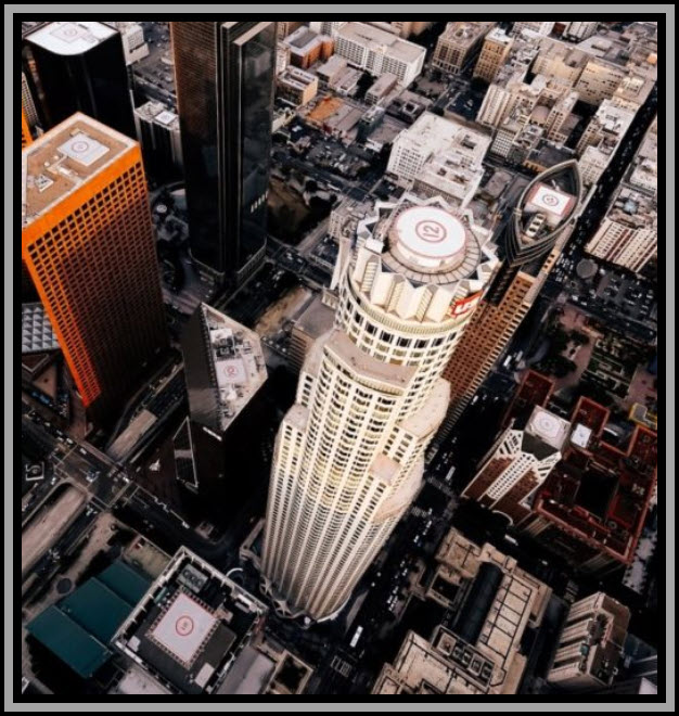
Urban Hot Spots: Residential neighborhoods and urban areas emerged as high-risk zones due to frequent low-altitude drone activity. These areas pose challenges for emergency helicopters and future AAM (Advanced Air Mobility) operations.
Remote ID Limitations: While Remote ID has been mandatory since 2023, only about 50% of Part 107-registered drones were compliant by mid-April 2025. The study found that most Remote ID signals were received within a 1-mile radius of sensors, revealing gaps in transmission range and data coverage.
Geofencing Concerns: The removal of geofencing by DJI—whose drones made up nearly 90% of those tracked—was flagged as a major safety risk. Without automated restrictions, drones can now enter TFRs, No Drone Zones, and critical infrastructure areas more easily.
Like recent NTSB recent condemnations[1], it would appear to be unwise to allow the White House directions[2] to overwhelm these substantial safety concerns. A SIGNIFICANT ACCIDENT INVOLVING A DRONE AND AN AIRCRAFT WILL LIKELY DETRACT FROM THE GROWTH OF THIS INNOVATIVE AND POTENTIALLY POWERFUL NEW FORM OF COMMERCE.
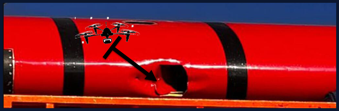
California Firefighting Aircraft disabled by drone collision
FAA Study Led by Embry‑Riddle Warns of Drone Risks to Aircraft
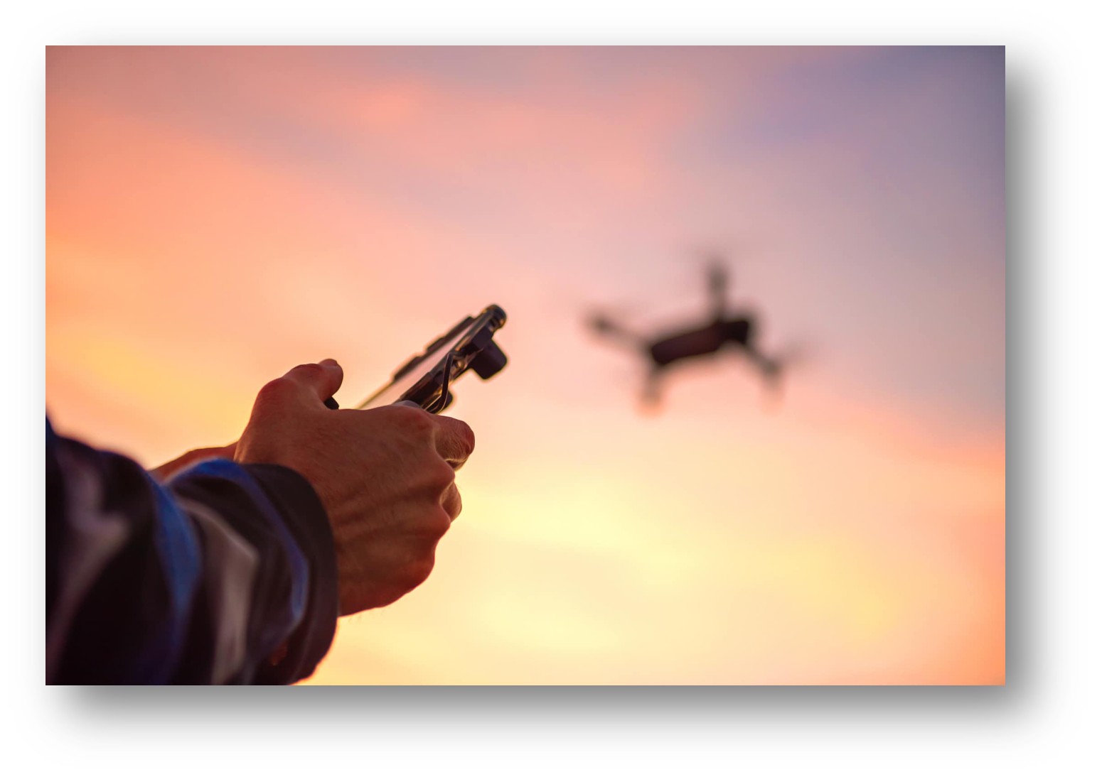
Drones, or uncrewed aircraft systems (UAS), are flying above the 400-foot ceiling established by the FAA, according to Embry‑Riddle Aeronautical University research. (Photo: Getty Images)
Michaela Jarvis /
Jul 15, 2025, 8:26 AM
S
A nationwide analysis of drone activity led by researchers at Embry‑Riddle Aeronautical University (ERAU) documents increasing growth in the use of drones and reveals “HOT SPOTS” where the RISK OF A MID-AIR collision with manned aircraft MAY BE HIGHER.
The study, which was conducted for the Federal Aviation Administration, provided critical information characterizing patterns of when and where small uncrewed aircraft systems (UAS) are flying — in order to assess and possibly mitigate any potential hazards associated with those patterns as drone use increases. Small UAS refer to drones weighing less than 55 pounds.
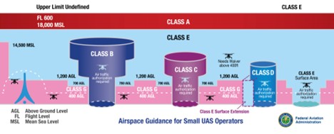
Among its observations, the report found that small UAS operators SOMETIMES FLY ABOVE THE 400-FOOT CEILING established by the FAA for drone flight.
“Study data suggests that a sizable number of small UAS flights take place above that altitude, which could impact the operation of manned aircraft,” said Dr. Ryan Wallace, associate professor in the Aeronautical Science Department and principal investigator of the project.
Of
- 6,037 documented flights that had associated altitude information,
- at least 573 hit an altitude of between 400 and 500 feet,
- and
- at least 781 flew to 500 feet or above, according to the study.
Taking flight duration into account, the researchers calculated that drones flew in airspace typically used by manned aircraft about 10 PERCENT OF THE TOTAL CUMULATIVE FLYING TIME that was observed. The data also suggested that flights above 500 feet were probably recreational, rather than commercial, based on the types of drones used. Some of the drones that flew above 400 feet may have still been operating with FAA approval — such as under a waiver or certificate of authorization — but the research did not discern those distinctions.

Aviation Ph.D. candidate and graduate research assistant SANG-A LEE briefs the research team about
UAS sightings and registration data to help contextualize the research findings. (Photo: Embry‑Riddle/David Massey)
Heightened risk is also associated with small UAS flying near airports, especially heliports. HELIPORTS ARE NOT NOTED ON AERONAUTICAL CHARTS, ACCORDING TO WALLACE, AND “ARE OFTEN HIDDEN WITHIN URBAN SPRAWL.”
The researchers analyzed 43 aerodromes, meaning airports of all types. Small UAS were detected operating closest to heliports at distances within 0.5 nautical miles, about 3,000 feet.
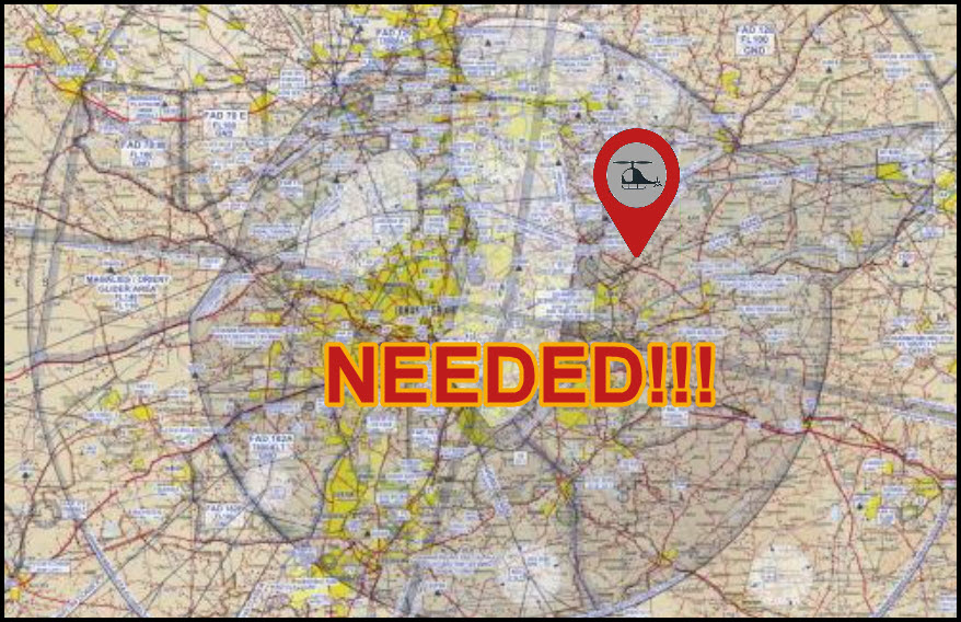
Wallace said the report specifically RECOMMENDS INCLUDING HELIPORT LOCATIONS ON AERONAUTICAL charts to make drone operators more aware of those locations.
Dr. Brent Terwilliger, associate professor in the Embry‑Riddle Worldwide Department of Aeronautics and contributing researcher, said the most important part of the analysis was its creation of “a real-world, data-driven picture of how small UAS are ACTUALLY BEING USED in the National Airspace System,” adding that such information is “essential for shaping informed, practical policies and technologies that will enable safe, scalable integration of UAS as operations and autonomy continue to expand.”
Wallace said the commercial applications of drones — which are already used in crop monitoring, public safety, search and rescue, safety inspection and more — will expand. Also, CHANGES[3] in beyond-visual-line-of-sight rules — regarding flying drones beyond where a pilot or other observers can see them — are expected to increase the use of the uncrewed aircraft.
John Robbins, chair of the Department of Aeronautical Science, said the findings of the study will help uncrewed aviation to naturally evolve. “These researchers are truly paving a pathway into the world of tomorrow.”
Also involving researchers from Kansas State University and Wichita State University’s National Institute for Aviation Research, the study was conducted using sensors placed across the country that collected data from Remote Identification signals, which the FAA has required registered drones to transmit since 2023.
Wallace praised the FAA Remote ID policy. He said it was “bearing fruit by providing the FAA with important information on small UAS activity hot spots or areas of elevated risk” that can aid the agency in developing effective safety regulations.
Dr. Stephen Rice, a professor in the Human Factors and Behavioral Neurobiology Department who also participated in the research, said he was surprised by “the sheer number of drone flights operating near airports.”
Sang-A Lee, a Ph.D. candidate in Aviation who worked on the study, said it will “enhance the safety framework” for the operation of drones.
“This research helps inform both current policy gaps and future regulatory priorities,” Lee said.
Dr. Scott Winter, associate dean for research in the College of Aviation and a co-principal investigator on the project, called the research “groundbreaking.”
Winter said the study will enable “informed decision-making by industry and government.”
[1] NTSB Chair Jennifer Homendy delivered a scathing critique of the Federal Aviation Administration (FAA) during recent hearings on the deadly January 29, 2025, midair collision near Reagan National Airport (DCA), which killed 67 people. Her remarks centered on the FAA’s failure to act on known safety risks involving helicopter and commercial aircraft proximity:
[2] The head of Space X has repeatedly eschewed the safety admonitions, issued by the FAA– CORRECTIVE ACTIONS SpaceX must take to prevent mishap reoccurrence. Corrective actions include redesigns of vehicle hardware to prevent leaks and fires, redesign of the launch pad to increase its robustness, incorporation of additional reviews in the design process, additional analysis and testing of safety critical systems and components including the Autonomous Flight Safety System, and the application of additional change control practices.
[3] 08/07/2025 NPRM issued UAS Beyond Visual Line-of-Sight Operations
Department of Transportation
Federal Aviation Administration
- 14 CFR Parts 36, 43, 45, 48, 89, 91, 107, 108, 119, 133, 135, 137, and 146
- [Docket No. FAA-2025-1908; Notice No. 25-07]
- RIN 2120-AL82
Department of Homeland Security
Transportation Security Administration
- 49 CFR Parts 1540 and 1544
